I'm sorry but this page is
not yet translated.
It will be completed by spring 2025 at the latest
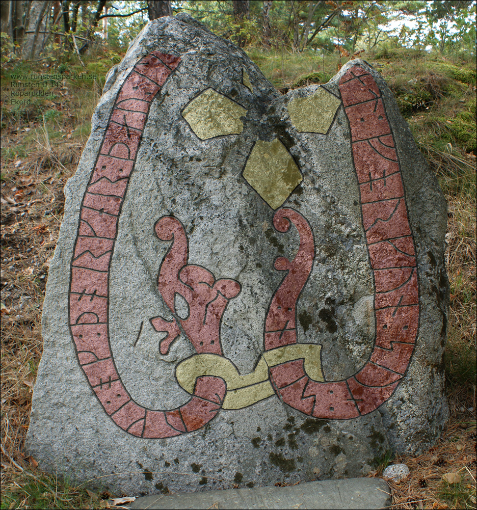
Runinskrift
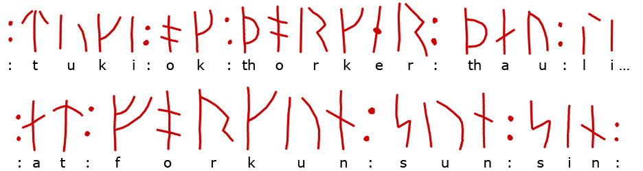
Toke och Torgärd de lät ...
- ... åt Forkun son sin
Runristare:
Ärnfast ?
Jag tror att det här är ett verk av
den unga Ärnfast i en tid då han fortfarande prövade sig fram. Drakens huvud
gör han
riktigt fult för att
skrämmas... fast då blev resultatet
som helhet inte särskilt bra, och vad jag vet nu så upprepas
inte den detaljen.
Förutom detaljer i ornamentik
och runornas former som jag kopplar till Ärnfast så ser jag
en annan sak som gör mig mer övertygad om att det här är ett
verk av Ärnfast, runinskriftens utformning.
Den förlorade överdelen borde
innehålla orden: "litu raisa stain
densa åt/efter" men alla dessa ord kan inte ha
fått plats... så vad stod där då i stället?
Om vi tittar på de tre andra
tidiga runristningar jag tror Ärnfast har gjort så hittar vi
lösningen. Ärnfast hoppar helt enkelt över vissa ord, ord
som läsaren ändå vet ska finnas där som just "raisa
stain thena".
Jämför hans förkortningar på
U 40 i Eneby,
U 52 i Edeby och den
förstörda U 123 i
Karlberg
som båda sannolikt är ristade av Ärnfast som ung runristare.
U 52 Edeby
Afrid lät (hugga hällen)
åt Svarthövde och åt Igulfast, söner sina, och åt Asgöt
U 123 Karlberg
Sigfast och Ärnfast de höggo
(stenen) åt sig
U 40 Eneby
Åsbjörn ... - ... Gunnälv lät
(resa stenen) åt Åsulv, fader
sin.
U 14 Roparudden
Toke och Torgärd de lät .?.
- .?. efter Forkun son sin
Fakta:
Sten av granit.
Storlek: 1,15 x 1,55 m.
Ytan är ojämn och skrovlig.
Historik:
I mitten på 1800-talet sägs
att den ligger omkullfallen med ristningen nedåt och i
början av 1900-talet att den låg vid stranden men att den
flyttades och restes ca 15 meter högre upp på uddens södra
sida.
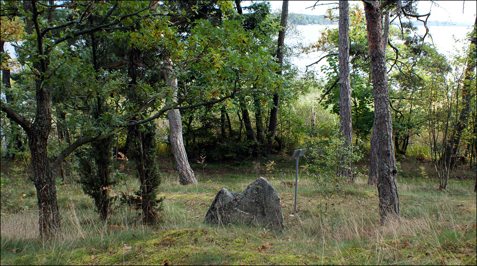
Bild mot öster och baksidan av
runstenen.
På andra sidan fjärden syns Färingsö.
Kalle funderar
Platsen och udden har även kallats
för Munkudden. Namnet har koppling
till den lilla ön mitt i den fjärden som heter Munken.
Under vikingatid när vattennivån stod 5 meter högre upp på
land låg ön under ytan och måste ha varit
ett farligt grund, ett grund som på något sätt borde ha
varit utmärkt för att förhindra olyckor i den trafikerade
leden.
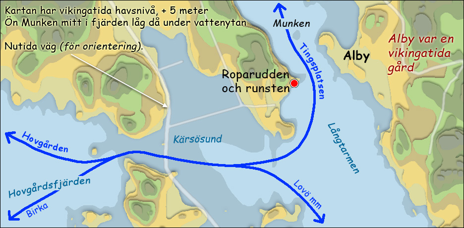
Under vikingatid seglade man
obehindrat genom Kärsösund. Då låg Roparudden och runstenen
mitt i en trafikerad farled.
Roparudden?
Vad ropade man efter?
Jo efter en båt på andra sidan
sundet som kunde hjälpa en
att ta sig över.
På andra sidan sundet fanns gården Alby
under vikingatid. Jag gissar att namnen i runstenens runinskrift: "Toke, Torgärd
och Forkunn" alla hör till den gården eftersom det på Roparuddens sida
inte finns
någon boplats som kan kopplas till runstenen.
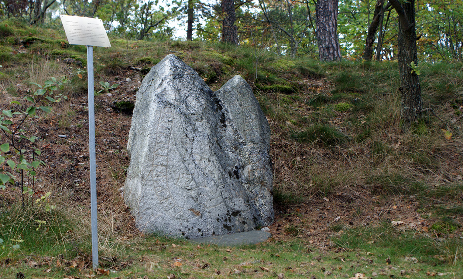
Bild från 2008
Länkar
Upplands runinskrifter > Sidan
22
Runor > Riksantikvarieämbetet
Google map > Hitta till runstenen
kalle@runristare.se
If you want to be of help or have a question.
ALL
RUNESTONES
Ekerö
municipality
ADELSÖ >
has 5
known runestones
BIRKA >
has fragments from 9 known
runestones
MUNSÖ >
has 3 or
4 known runestones
EKERÖ >
has 11 known runestones
FÄRINGSÖ
>
has 27 known runestones
LOVÖ >
has 8 known runestones
|